 Top-Views
 New-Updates
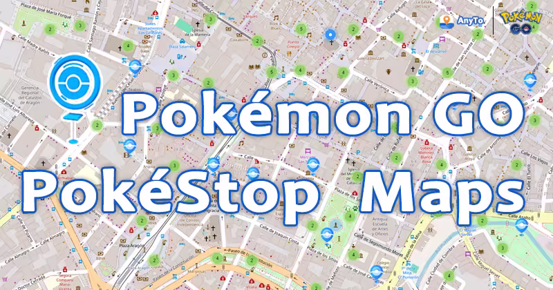
Find PokéStops, Gyms, and Raids, then teleport straight to the hotspots in Pokémon GO within one app! No jailbreak or root required.
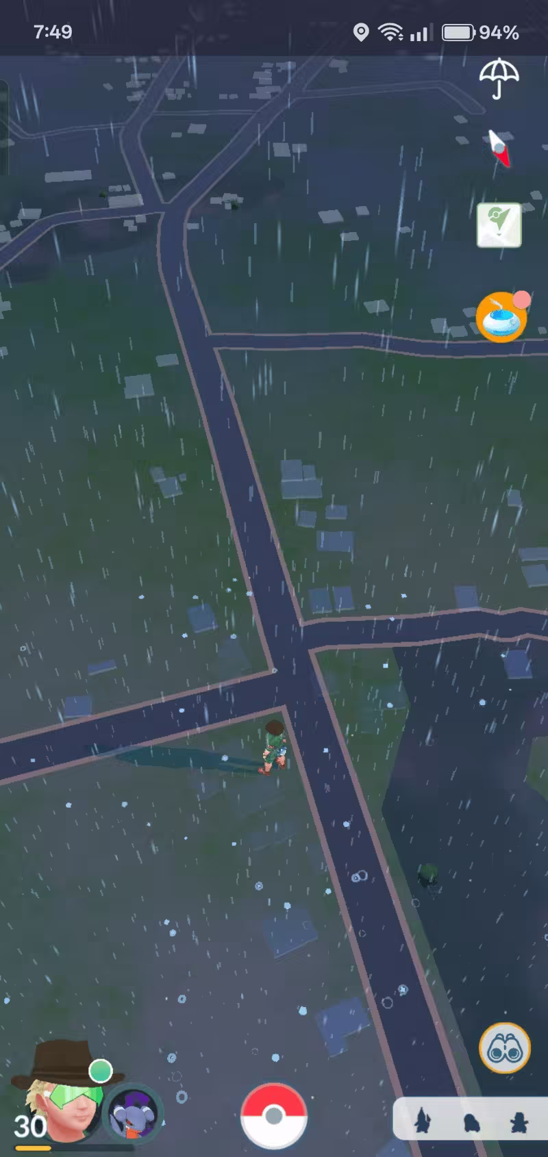
PokéStops are essential in Pokémon GO. They provide valuable items, quests, and encounters, typically placed at real-world points of interest, like public art, historical markers, and community hubs.
However, the density varies greatly depending on your location. That's where a PokéStop map comes in handy, especially if you're planning to drop multiple lure modules or maximize your walking route.
Quick Navigation

How Can I Find Good Spots for PokéStops?
Short answer: you'll need a real-time map of PokéStops.
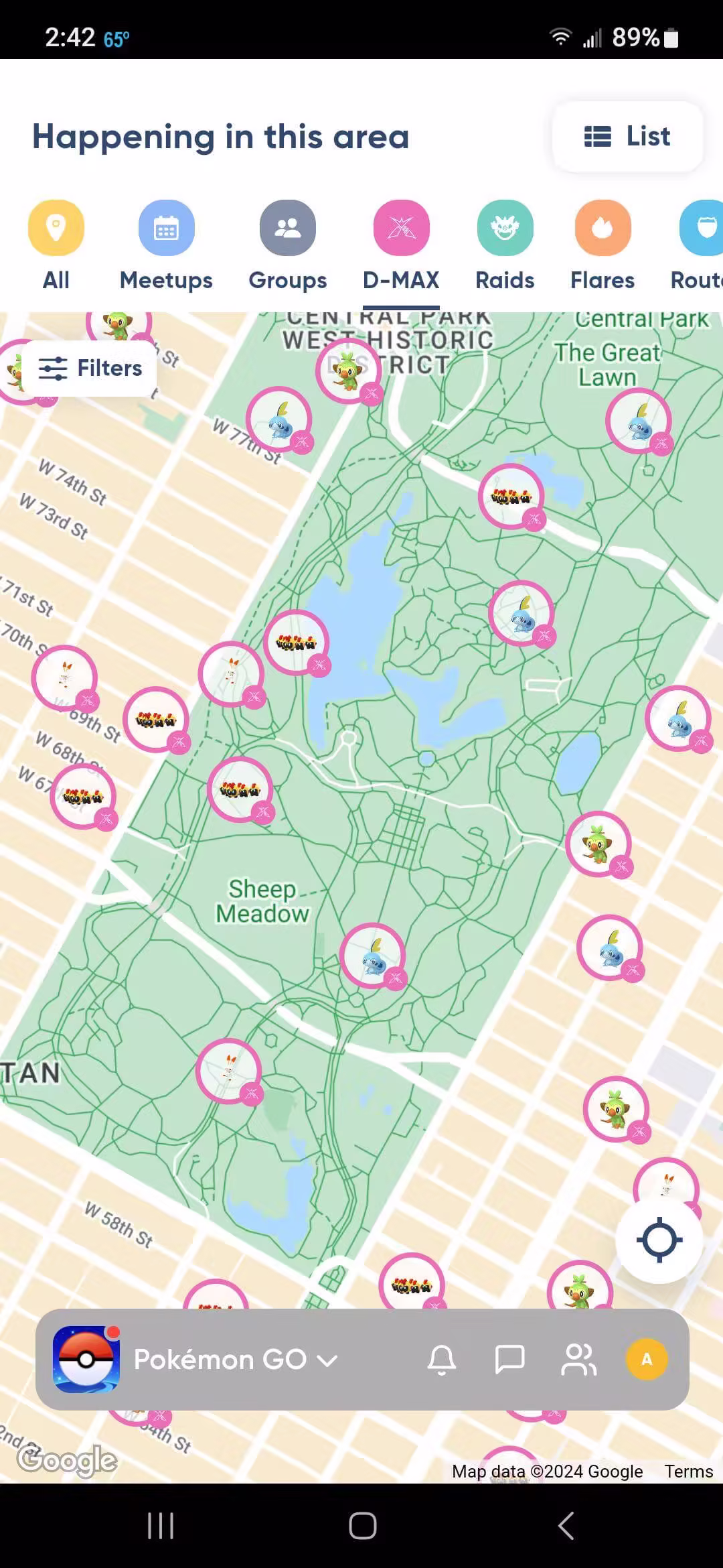
Indeed, PokéStops tend to cluster in public spaces like parks, libraries, malls, and college campuses. These are great places to stock up on items and complete field research tasks.
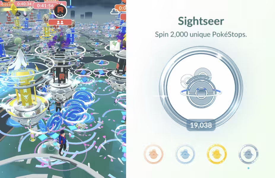
But if your goal is simply to spin some new PokéStops nearby to get the Sightseer Medal, then PokéStop maps can be a real lifesaver. These maps let you visualize local PokéStop locations in real time, helping you plan efficient walking paths, find dense clusters for dropping lures, or even encounter new spawns.
Best 6 Global Pokémon GO PokéStop Map
Ever since Campfire was introduced, many third-party tools like PokeHunter have gone offline or become outdated. In 2026, the following six maps remain reliable and widely used by Trainers to locate PokéStops worldwide.
1 Campfire
Originally launched by Niantic as a companion app for coordinating Raid Battles, Campfire also doubles as a Pokémon GO Gym Map. Since Gyms are usually created from dense PokéStop areas, spotting a Gym cluster on Campfire typically means you'll find plenty of Stops nearby.
However, Campfire isn't a dedicated PokéStop map.
- Accuracy: Incomplete—many standalone PokéStops aren't shown, especially those not linked to Routes.
- No S2 Cell Overlay: Planning around Ingress mechanics is not possible here.
- Platform: Mobile-only app, not ideal for mass route planning or wide-area scouting.
Still, it's a solid option if you're on the go and looking for high-traffic PokéStop zones.
2 AnyTo Live PokéStops Map
AnyTo's PokéStops Map is a real-time, global tracker designed specifically for Pokémon GO players.
It not only shows the location of PokéStops but also displays Gyms, wild Pokémon spawns, ongoing Raids, and even Routes in Pokémon GO.
If you want precision and full situational awareness before teleporting or walking somewhere, this is one of the most complete tools available.
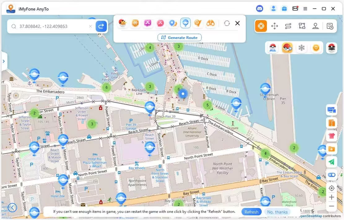
- High accuracy—frequently updated with live in-game data.
- Global coverage with zoomable maps and search support.
- Integrated with auto route planning, auto walk, teleportation and cooldown calculators for those who want to access PokeStops far away without moving.
- Includes filters for Pokémon type, IV ranges, Raid levels, and PokéStop lures.
- Desktop & mobile supported via AnyTo's built-in tools.
3 PogoMap
PogoMap is a crowd-sourced Pokémon GO map tool that displays PokéStops, Daily Field Research tasks, and even ongoing Raid Battles sorted by level. One unique feature is the Nest Migration countdown, which lets players prepare ahead for spawn changes every two weeks.
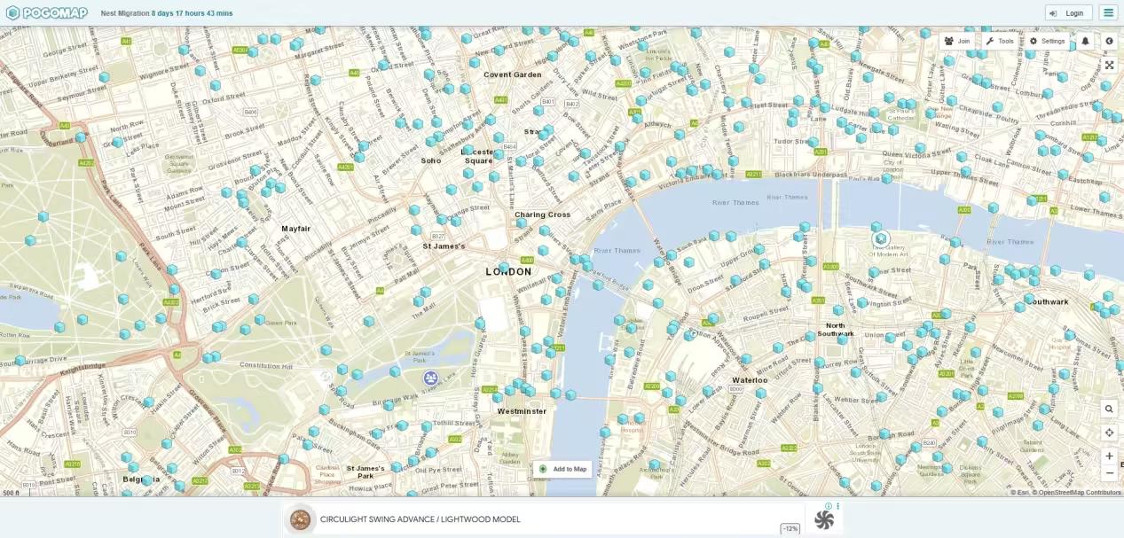
- Data accuracy depends on user submissions. To add a new PokéStop, you need the exact in-game coordinates (lat/long) and must manually submit it.
- The S2 cell borders shown on the map are not perfectly accurate, which can cause problems when trying to understand PokéStop placements for Routes.
- Requires some effort to contribute, but a helpful tool for active community mappers.
4 PokeMap
PokeMap is a real-time Pokémon GO map that displays PokéStops, and Pokémon spawns based on user reports. With a sleek interface and smooth performance, it has gained popularity among players looking for a quick and responsive map tool.
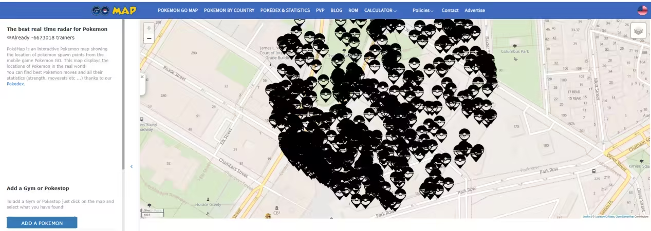
That said, PokeMap heavily relies on crowdsourcing. This means the data can be hit or miss depending on how active the player community is in your region. If you're in a bustling city, it's incredibly useful. But if you're somewhere quiet, the map might look a bit... empty.
- Relies heavily on community-submitted data, so accuracy can vary.
- Global coverage, but only as good as the local player activity. Great in major cities, inconsistent in rural areas.
- Browser-based. No need to download an app.
- Does not support S2 cells or route planning.
5 PoGo.tools
PoGo.tools is a fan-made toolset designed to help Pokémon GO players analyze their local PokéStop density using a layered map based on the Ingress Intel Map. It's particularly popular among advanced Trainers who want to understand spawn logic, cell distribution, and PokéStop eligibility.
- Moderately accurate, but depends on data pulled from Ingress. Some points of interest may be outdated or missing due to changes in Niantic's Wayfarer system.
- Global coverage, but quality varies. Highly reliable in urban areas with active Ingress agents; less so in rural zones.
- Web-based, desktop-friendly. Not optimized for mobile browsing, especially when viewing S2 cells or multi-layer data.
- Shows portals from Ingress that could become PokéStops.
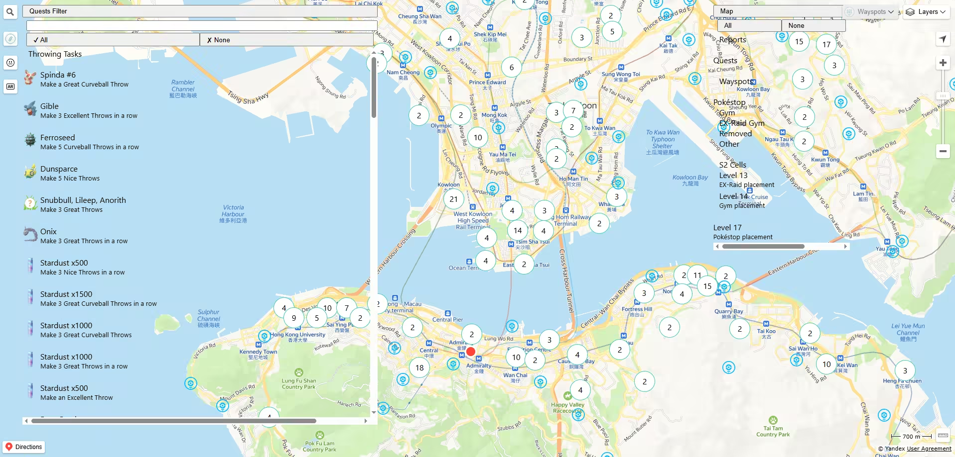
6 IITC (Ingress Intel Total Conversion)
IITC is a powerful mapping tool originally made for Ingress but widely used by advanced Pokémon GO players to study PokéStop placement rules. While it's not beginner-friendly, once set up, it gives you unmatched control over S2 cell analysis and portal visibility.
- High accuracy, since it pulls real-time portal data from Ingress. However, some wayspots eligible in Pokémon GO may be hidden in Ingress due to different proximity rules.
- Global coverage. Works anywhere the Ingress map has data—usually urban and suburban zones. Less effective in newly developed or rural areas unless updated manually.
- Available as a browser extension (Chrome, Firefox) and a mobile app on Android. Not recommended for casual mobile use without setup.
- Can determine why a Wayspot didn't appear in Pokémon GO.
Setup Guide (Simplified Steps)
- 1. Install Ingress & Create an Account
- You don't need to play Ingress—just register
- 2. Install IITC and Key Plugins
- Use IITC Mobile or a browser extension
- Add the pogo-s2 plugin to show Level 14 & 17 S2 cells
- Optional plugins can highlight potential PokéStop areas
- 3. Sign in & Configure Plugins
- Log in with your Ingress account
- Enable pogo-s2 and set it to show relevant S2 cells
- Customize views for better planning
- 4. Analyze for PokéStops
- View portals (possible PokéStops)
- Use the cell overlays to check eligibility
- You can even manually add potential new stops
Note
IITC was originally built for Ingress, not Pokémon GO. And with Pokémon GO splitting with Niantic, the sync between them is getting weaker.
8 Regional Maps of PokéStops Pokémon GO
Unlike global maps, these 8 focus on specific cities, offering smaller coverage but way more accurate and detailed PokéStop data.
| Map Website | Coverage Area | Country/Region | Notes |
|---|---|---|---|
| londonpogomap.com | London | England | — |
| sgpokemap.com | Entire country | Singapore | — |
| nycpokemap.com | New York City only | USA | — |
| sydneypogomap.com | Sydney | Australia | — |
| vanpokemap.com | Vancouver city only | Canada | — |
| shadowmon.net | Adelaide | Australia | — |
| 9db.jp/pokemongo/map | Tokyo | Japan | *Non-English |
| twpkinfo.com/ipoke.aspx | Taipei | Taiwan | *Non-English |
How Can I Access PokéStops Far Away without Moving?
If you live in a rural area, you know the pain. A 15-minute drive just to reach the nearest PokéStop. Not exactly the most convenient way to gather Poké Balls or spin tasks.
Fortunately, there's a way to access distant PokéStops without ever leaving your home.That's where AnyTo comes in. This location-changing tool lets you:

AnyTo's Key Features
- Teleport instantly to any location in the world — even if it's a PokéStop hotspot like NYC or Tokyo.
- Access its PoGO Atlas to discover high-density areas with stops, raids, and even rare wild Pokémon — all in one map.
- Auto-walk along a customized route so you can simulate walking between stops to hatch eggs and earn Buddy hearts.
- Plan multi-point routes to cover multiple PokéStops in one go.
- Use Virtual Go Plus, which enables automatic PokéStop spinning and catching — no tapping needed.
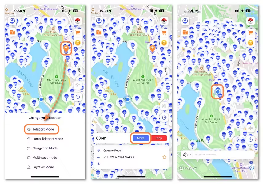
How to Teleport in Pokémon GO with AnyTo
Step 1. Download and install AnyTo. You can use the PC version to change your iOS/Android location through your computer, or go with the mobile app to spoof your location directly on your phone.
Step 2. Launch AnyTo, then tap on the Pokéball icon in the top-right to view PokéStops on the map.
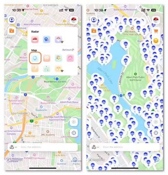
Step 3. Tap a PokéStop, select Teleport Mode, then hit Move, and your location updates instantly.
You can also change your phone's location via PC. For a more detailed handbook, see Users Guide of AnyTo PC Version.
 AnyTo Discord Server
How Can I Make A PokéStop?
You can actually submit your own PokéStop nomination in Pokémon GO. Here's a simplified step-by-step guide to help you do it:
1. Start Your Nomination
- Go to the object or location you want to nominate.
- Open Pokémon GO > Main Menu > Settings > Uploads.
- Tap New PokéStop to begin.
Note
Don't submit locations on private residential property. This applies specifically to single-family homes, even if it's your own.
2. Pin the Location
- Use the map to place the pin exactly where the object is located.
- Avoid placing it too close to existing PokéStops.
- Tap Confirm when the pin is accurate.
3. Take Photos
- Main photo: A clear, well-lit picture of the object or location.
- Context photo: Shows the surrounding area to prove accessibility and safety.
- Avoid blurry images or pictures with people, animals, or copyrighted content.
4. Add a Title and Description
- Title: Use the official name or a descriptive label.
- Description: Share something interesting—history, purpose, or fun facts.
Note
- Don't include links, usernames, or game-specific terms like "PokéStop" or "Raid."
- Don't say things like “our town needs more PokéStops.”Niantic already understands this—focus on what makes the location valuable. Highlight historical, cultural, or community significance.
5. Choose a Category
- Select the category that best fits the location (e.g., park, library, mural).
- If no match, choose "Other" and optionally suggest your own.
6. Final Review
- Check your nomination in the preview screen. If everything looks good, tap Confirm.
7. Justify the Nomination
- Briefly explain why this should be a PokéStop (e.g., promotes exploration, has historical value).
8. Submit for Review
- Tap Upload Now, or Upload Later if you're in a low-signal area.
9. Wait for Community Review
- Your nomination is sent to Niantic's Wayfarer community.
- Review time varies—can take weeks or even months.
- You'll get an email when your nomination is approved or rejected.
FAQs about Pokémon GO map with PokéStops
Can I make my house a PokéStop in Pokémon GO?
It's very unlikely to get approved. Niantic prefers public, safe, and permanent locations that are accessible to everyone. Private residential property is generally rejected during the review process.
Is there an app that shows you where PokéStops are?
Yes. Apps and tools like AnyTo PokéStop Map, PoGoMap, and Campfire let you view PokéStops, and raids worldwide. Some also show tasks, nests, and active lures.
How long does it take for a PokéStop to be approved?
It varies. Most nominations take weeks to a few months to be reviewed by the community. Sometimes, it depends on how active the reviewers are in your area.
How do I find PokéStops near me?
You can use the PokéStop map tool to preview the nearest stops or spot clusters around your location.
How do I visit more PokéStops without walking?
You can use a GPS spoofing tool like AnyTo to simulate walking, auto-navigate routes, or teleport to PokéStop-rich areas. Just make sure you follow cooldown rules to avoid soft bans.
Where do you get gold PokéStops?
Gold PokéStops typically appear during special events or when linked to Showcases and Routes. Interacting with them may offer bonus items, XP, or event-specific Pokémon.
Conclusion
Pokémon GO PokéStop maps are essentially helpful when you're hunting for high-density farming spots or planning lure parties with friends.
If there's no PokéStop nearby, don't worry. You can either submit your own PokéStop nomination, or take the easier route and use an auto-walker like AnyTo to virtually travel there without stepping outside.
Just remember, where there are PokéStops, there are always opportunities for rare spawns, XP, and items. So, grab a map, plan your route, and level up your Pokémon GO journey!
![]()
Ryan Miles is a seasoned gamer and mobile strategy writer with over 5 years of hands-on experience in Pokémon GO spoofing and GPS-based games. Known for breaking down complex location tricks into beginner-friendly guides, Ryan’s mission is simple: help you explore more, catch faster, and play smarter without ever leaving home.
-
How to Get Metal Coat in Pokémon GO (2026)
A complete 2026 guide to finding and using Metal Coat in Pokémon GO. Discover drop methods, best tips, and how AnyTo helps you farm rare items faster.
4 mins read -
What Are the Pokémon GO 50km Reward and How to Get it [2026]
Discover everything about the Pokémon GO 50km Adventure Sync rewards. learn the easiest way to claim them and why your Pokémon GO is not tracking steps.
17 mins read -
WeCatch Pokémon GO: Everything You Need to Know in 2026
Wondering if WeCatch for Pokémon GO is safe in 2026? Learn its features, problems, ban risks, and why AnyTo is the best alternative for rare Pokémon hunting.
6 mins read -
How to Get Master Ball in Pokémon GO 2026 Full Guide
Learn how to get the Master Ball in Pokémon GO 2026, the rarest type with a 100% catch rate. Discover how to use it wisely & the best Pokémon to save it for.
5 mins read -
[Guide] How to Fly in Pokémon GO Without Getting Banned
Learn what “flying” means in Pokémon GO, the best tools to do it, common problems you may encounter, and what to avoid to keep your account safe!
4 mins read -
How to Make a Gym or PokéStop in Pokémon GO (2026 Guide)
Learn how to create a Gym or PokéStop in Pokémon GO, how to submit nominations, what locations are not allowed, and tips to boost your approval chances.
22 mins read
Was this page helpful?
Thanks for your rating
Rated successfully!
You have already rated this article, please do not repeat scoring!